
Enjoy expansive views of Lake Chelan from high above the valley on the 7.4 mile (12km), out and back Chelan Butte Trail. Chelan Butte’s modest 2275′ (.7km) elevation may not seem too impressive but the humble promontory remains one of the most popular peaks to summit in Chelan County.
Chelan Butte is located at the south end of Lake Chelan, rising up between the lake and the Columbia River. Although a low-elevation peak, Washington’s 103rd-most prominent, the butte stands alone, with no other peaks nearby to block its far-reaching views.
The summit was the site of a historic 1938 fire lookout tower, since relocated to the Columbia Breaks Fire Interpretive Center near Entiat, WA. More recently, the top of the butte has become festooned with a number of communications towers. It’s also one of the area’s most popular hang-gliding spots, with a dedicated launch area located south of the summit.
Although the communications towers are restricted, public access to the summit of the butte is permitted. There’s even a dirt road, Chelan Butte Road, that will take you all of the way to the top. The road is often in fairly rough shape, however, and most prefer the hike.
Reaching the Trailhead
Getting to the Chelan Butte Trailhead from Kelly’s Resort is a snap.
- 1. Head southeast along the shore of Lake Chelan for around 13.5 miles (21.8km) on South Lakeshore Road, then US-97.
- 2. Turn right onto South Farnham Street before the Webster Avenue bridge.
- 3. Follow Farnham St for around a half a mile (.8km) as it changes to S. Sanders Street.
- 4. Take a left on East Iowa Street and follow it for around .2 miles (.3km) until you see the Chelan Butte Trailhead parking lot at 1015 Gorge Rd, Chelan, WA 98816.
The start of the Chelan Butte Trail is located across the street from the parking lot.
If you’d prefer to try to reach the summit using the Chelan Butte Road, follow South Lakeshore Road and US-97 south from Kelly’s Resort. Take a right on South Millard Street, about 12 miles from Kelly’s on 97, and follow it as it becomes the Chelan Butte Road.
Hiking to the Summit
The Chelan Butte Trail is rated as difficult because it is essentially 3.7 miles of up, up, up. Route signs posted along the way help to keep you oriented. Though there is no shade along the trail, there are occasional benches and no end to the great views.
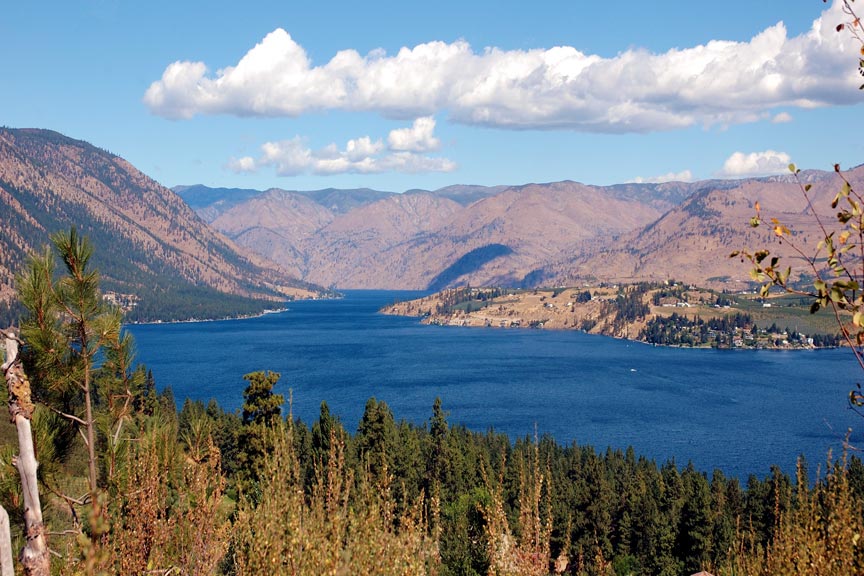
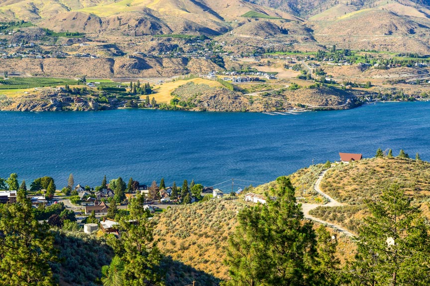
Follow the trail along the ridge line and enjoy the 360 degree views as you approach the peak. The view from the top is incredible. Looking northwest, you can see the length of Lake Chelan. Looking south, your view looks over Columbia River and Chelan Falls towards Wenatchee and Mission Ridge.
The actual summit is enclosed by a fence but the highest public point is a large boulder located on the east side of the communications towers. This can be reached by walking on the rocks along the fence. Anchors for the historic, 1938 fire lookout can also be found in some of the summit boulders.
Enjoy the views, rest a bit and, when you’ve had enough, reverse your course to get back to your vehicle. Hey – at least the return trip is all down hill!
Reflect on the experience over some rejuvenating food and drink in town or back at your comfy digs at Kelly’s Resort. Then for some rest. Tomorrow is another day full of fun and adventure on Lake Chelan!